Our next destination was Canyonlands National Park. The Park covers a vast area divided by rivers into four districts: Island in the Sky, The Needles, The Maze, and the rivers themselves. It has countless canyons and fantastically formed buttes carved by the Colorado River and its tributaries.
The Maze is the least accessible district of Canyonlands. Due to the district’s remoteness and the difficulty of roads and trails, travel to the Maze requires more time. Visitors must be prepared for self-sufficiency and have the proper equipment or gear for self-rescue.
The Needles forms the southeast corner of Canyonlands and was named for the colourful spires of Cedar Mesa Sandstone that dominate the area.
The Island in the Sky mesa rests on sheer sandstone cliffs over 1,000 feet (304 m) above the surrounding terrain. Every overlook offers a different perspective on Canyonlands’ spectacular landscape.
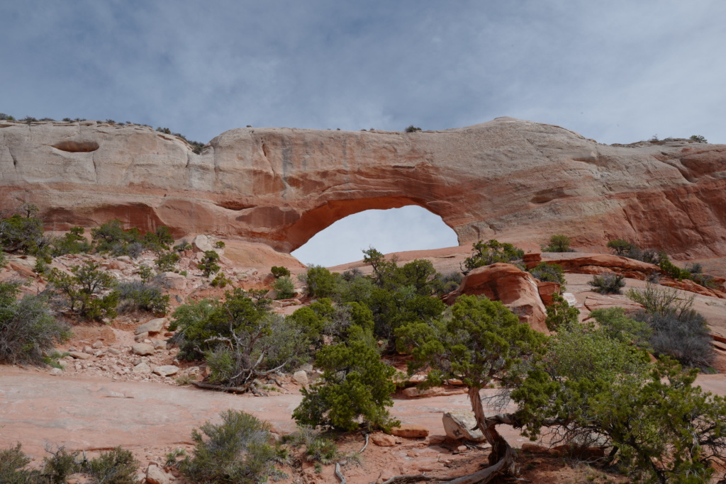
Coming from Blanding, The Needles was the District we chose to visit. It is still quite a way to get to the visitor centre ( 35 miles/ 56km) from the turn off on road 191 ! We then took the scenic drive and stopped at several viewpoints and did some short hikes.
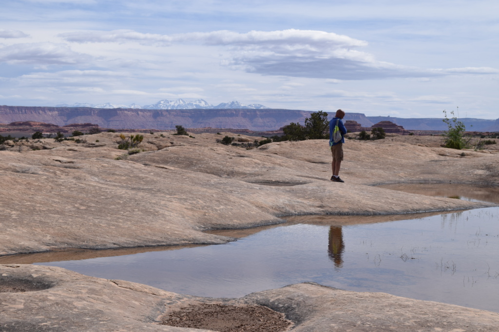
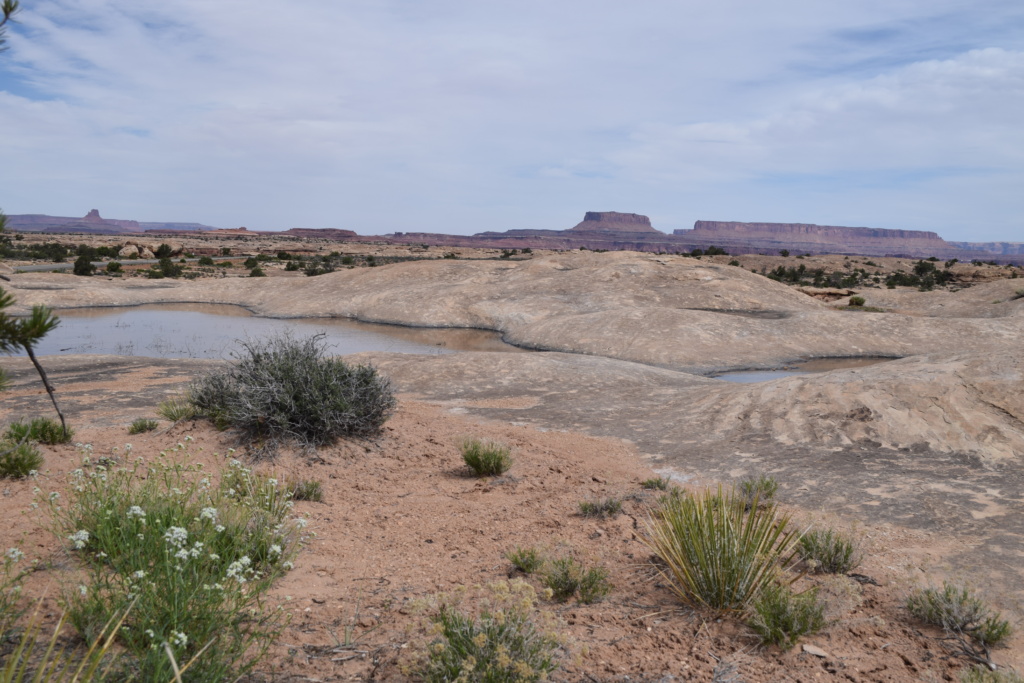
Pothole Point trail takes you around slickrock (outcroppings of smooth, weathered sandstone.) dimpled with pockets called potholes which fill with water after rain.
You also get nice views of the Needles in the distance
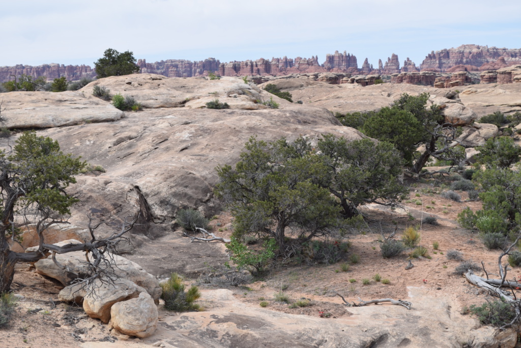
Slickrock trail climbs slightly to the top of a treeless sandstone plateau, has a series of viewpoints of squat pinnacles and low cliffs and across to the higher, reddish peaks of the Needles. We were surprised by the variety and abundance of wild flowers on this trail growing in shallow hollows where sandy soil accumulates.
[Click on picture to open gallery]
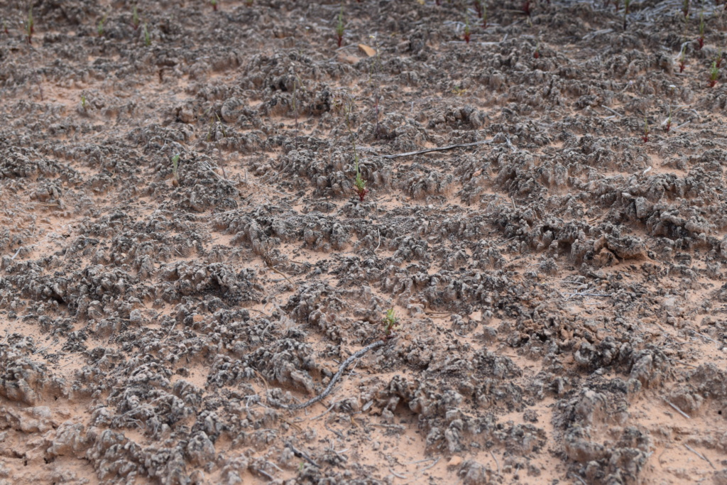
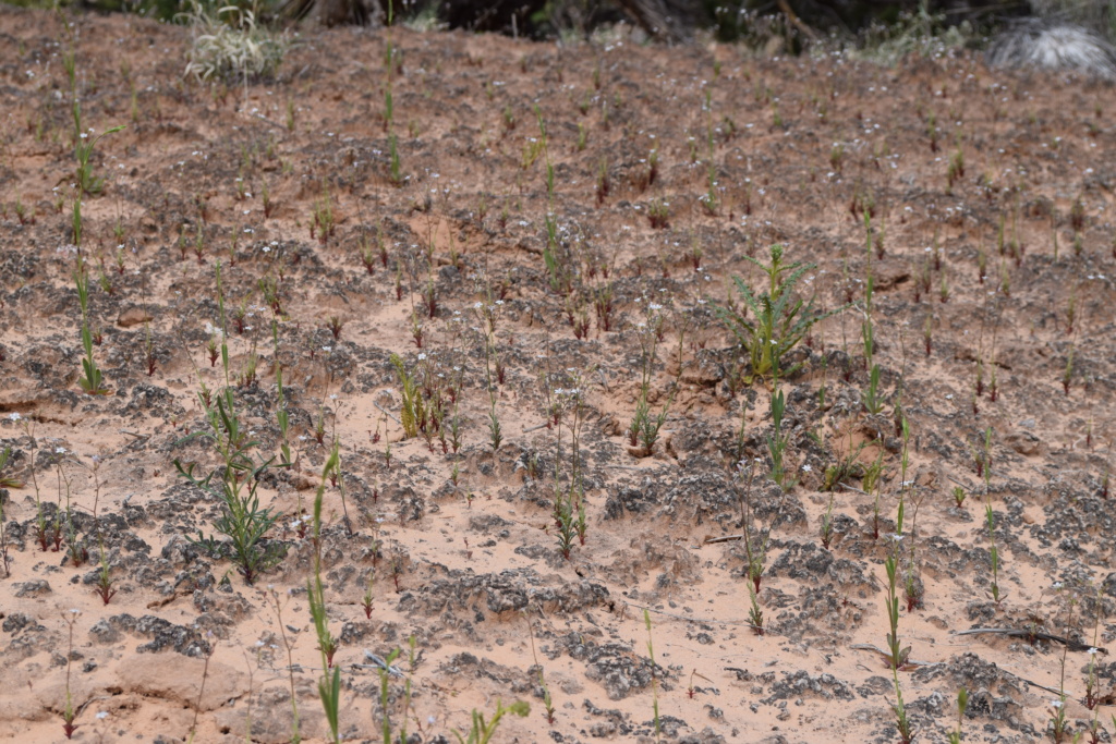
The bumpy soil along the trails does not look like anything could grow there but in fact it is alive!… but very fragile and you are asked to stay on the trails. Biological soil crusts are living communities of cyanobacteria, mosses, algae, lichens, and fungi. They create a sort of web which prevents erosion, stores moisture, and provides critical nutrients for plants.
It only takes a bit of water and soon plants appear.
Flower picture show!!
[Click on picture to open gallery]
Big Spring Canyon Overlook, at the end of the scenic drive offers unique views on rock spires and multi-colored sandstone benches lining the bend in the canyon.
[Click on picture to open gallery]
On the way to Dewey
We then took the Upper Colorado Scenic Byway (Hwy 128) which offers great scenery along the Colorado River following a canyon with towering mesas on each side of the river. We stopped for the night at Dewey. This town was originally named Kingsferry as a ferry was operating across the Colorado until the Dewey Bridge was constructed in 1916. This is now a ghost town, and only the remains of a wooden suspension bridge remains.
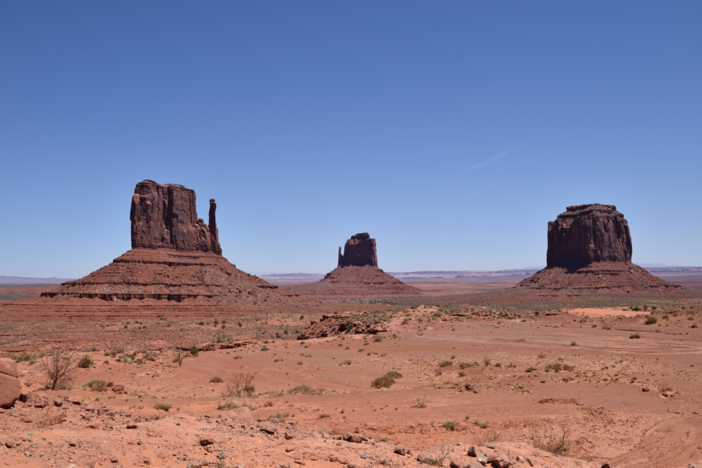
Monument Valley, a red-sand desert region on the Arizona-Utah border, is known for its towering sandstone buttes. The valley is a sacred area that lies within the territory of the Navajo Nation Reservation, The park, frequently a filming location for Western movies, is accessed by the looping, 17-mile Valley Drive.
Monument Valley has been featured in many forms of media since the 1930’s. Director John Ford used the location for a number of his Westerns; critic Keith Phipps wrote that “its five square miles (13 square km) have defined what decades of moviegoers think of when they imagine the American West. The famous, steeply sloped Mittens buttes can be viewed from the road or from overlooks such as John Ford’s Point.
The two Mittens Buttes
[Click on picture to open gallery]
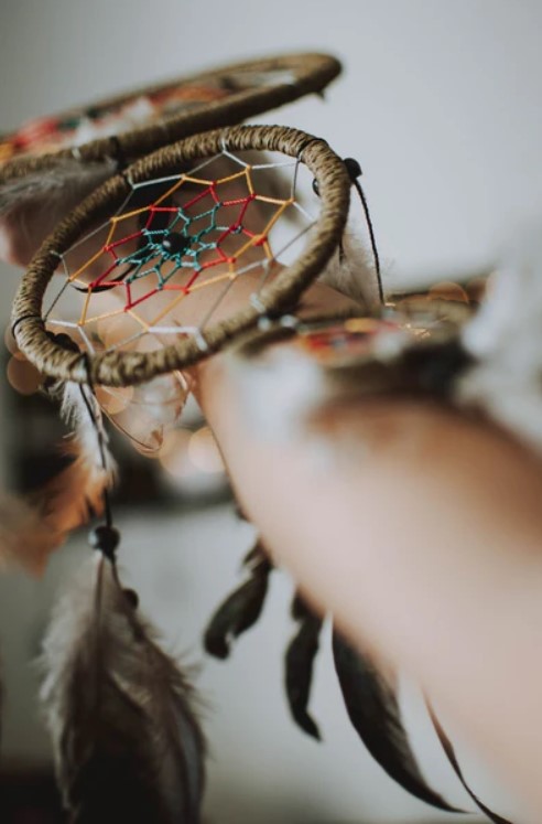
Dreamcatchers
These dreamcatchers were for sale at a stall. They are not totally traditional though.
The meaning of dreamcatchers and the beliefs surrounding their construction originate from Native American cultures. The dreamcatcher is a protective talisman that is used to protect people from nightmares and bad dreams. The charm was usually used for young children and hung above their cradles or beds.
Native American cultures believe that both good and bad dreams fill the air at night. The dreamcatcher acts like a spider’s web by trapping the bad dreams or visions while allowing the good ones to filter through. The bad dreams caught in the web get destroyed when the sunlight of morning hits the dreamcatcher, while the good dreams filter down through the feathers and gently reach the sleeping person below.
Dreamcatchers can also be considered as charms that provide protection from any kind of evil influence, not just from bad dreams and nightmares. Some tribes believe that dreamcatchers work slightly differently as their legend states that the good dreams or ideas would become trapped in the web while the bad ones would pass right through the hole in the center and would be gone forever.
Example of a more traditional dreamcatcher
Each section of the dreamcatcher’s form holds specific meaning.
The circular frame symbolizes Mother Earth and everything that sustains life. Its circular shape also represents the continuous flow of life as there is no beginning or end. In addition to representing the circle of life, it also symbolizes how the sun and moon move across the sky every day in a continuous loop.
The web or net of the dreamcatcher is intricately woven inside the frame to mimic the look of a spider’s web. The circle in the center of the web is its heart and is where the good dreams and visions are filtered through.
The number of points on the woven web of the dreamcatcher is also significant and holds different meanings. A dreamcatcher with 13 points represents the 13 phases of the moon, 8 points symbolizes the spider woman in the Native American legends, 7 points refers to the seven prophesies, 6 points represents an eagle, and 5 points symbolize a star.
Dreamcatchers have become popular souvenirs and many Native American cultures believe that they have become too commercialized, misused and their meaning has been lost.
Valley of the Gods
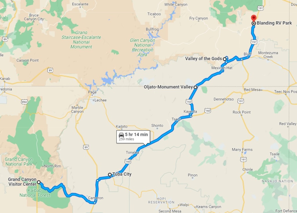
We continued on the road towards Blanding and stopped for the night on the way to Valley of the Gods, a hidden gem, not as well known a Monument Valley but similar, on a smaller scale.
[Click on picture to open gallery]
In the morning we were woken up by the sound of air balloons being inflated near by and watched as a dozen or so balloons flew all around us.
Blanding
We decided to stop at Blanding and spend a lazy afternoon at an RV park where we could enjoy the luxury of flush toilets and a hot shower!!
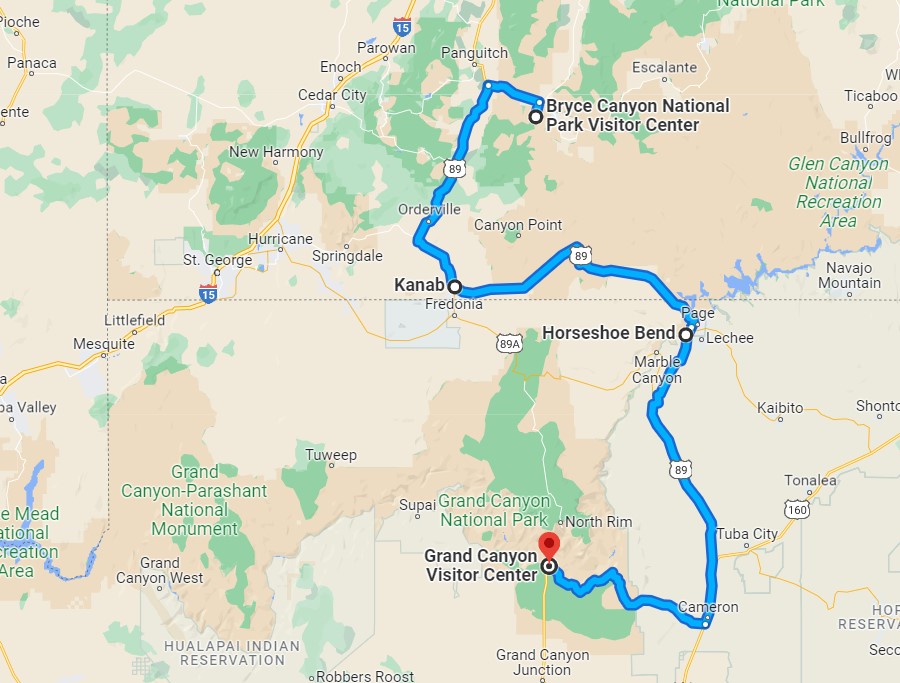
On the way to the Grand Canyon, we stopped at Horseshoe Bend State Park. We were in Arizona again !
Horseshoe Bend SP is a horseshoe-shaped incised meander of the Colorado River located near the town of Page. There is a short hike to get to it from the car park and the view is definitely worth the effort.
Horseshoe Bend – Arizona
GRAND CANYON
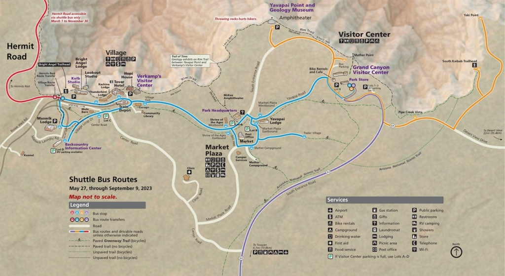
Grand Canyon – South Rim Shuttle routes
We entered the Grand Canyon National Park at the Eastern entrance and drove on the Desert View Drive (22.5 miles – 36km) which has a number of view points. When we got to the Visitor Centre, it was late afternoon so we parked and walked to Mather Point, the most popular viewpoint on the South Rim of the Grand Canyon especially at sunset.
[Click on picture to open gallery]
The next day we took the Red Route shuttle or Hermit’s Road (map above). This is the only one where access is restricted and you have to use the free shuttle. The shuttles are frequent and you never have to wait for long. They stop at view points and trail heads along each route and are an easy way to travel to all the major points.
Hermit’s Route follows the Rim Trail and we walked some of the distance between stops . Later in the day we took the same shuttle again and stopped at Hopi Point, another vantage point to admire the sunset. This is further west than Mather Point and has unobstructed canyon vistas. It is a popular stop for sunrise & sunset viewing but we were a bit disappointed as it was not as colourful because some light clouds appeared and blocked the setting sun.
[Click on picture to open gallery]
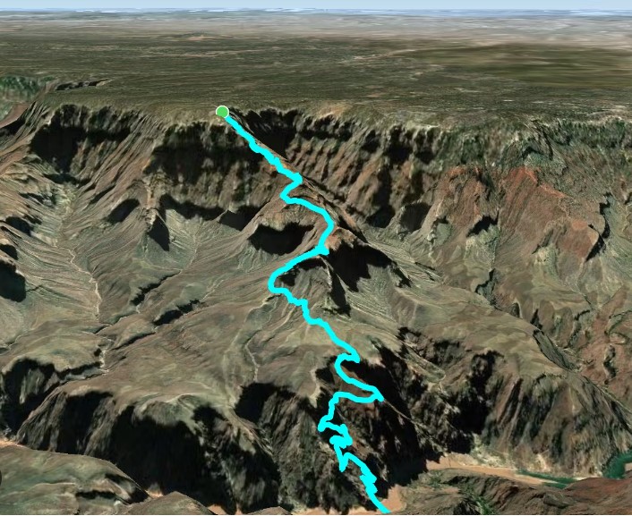
South Kaibab Trail
For our last day at the Grand Canyon, we planned to do part of the South Kaibab Trail which goes down to the floor of the Canyon.
The total length of the hike, one way, is 11 km ( 6.7 miles). It is a strenuous hike: the steepness of the trail is very misleading on the way down. You start at 2,200 m and finish at 755m !! quite a drop … It takes twice as long to hike up as it takes to hike down and for that reason it is recommended to complete the hike over two days, spending a night at a primitive campground at the bottom of the Canyon.
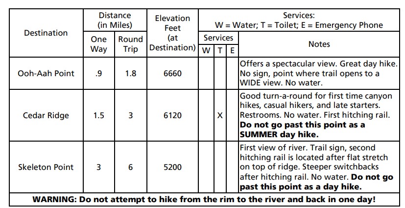
You can choose a few points on the way down as your final destination and turn this hike into a day hike. As you can see from the extract from the Park leaflet below, there are numerous warnings about not attempting the whole hike in one day, especially in summer…
We went as far as Cedar Ridge but felt we could have gone as far as Skeleton Point. The views on the way down were fantastic though and that makes it up for the slight disappointment of not having gone further!
[Click on picture to open gallery]
We finished the day by jumping on the shuttle to Yaki Point and walk on the South Rim Trail for a couple of miles.
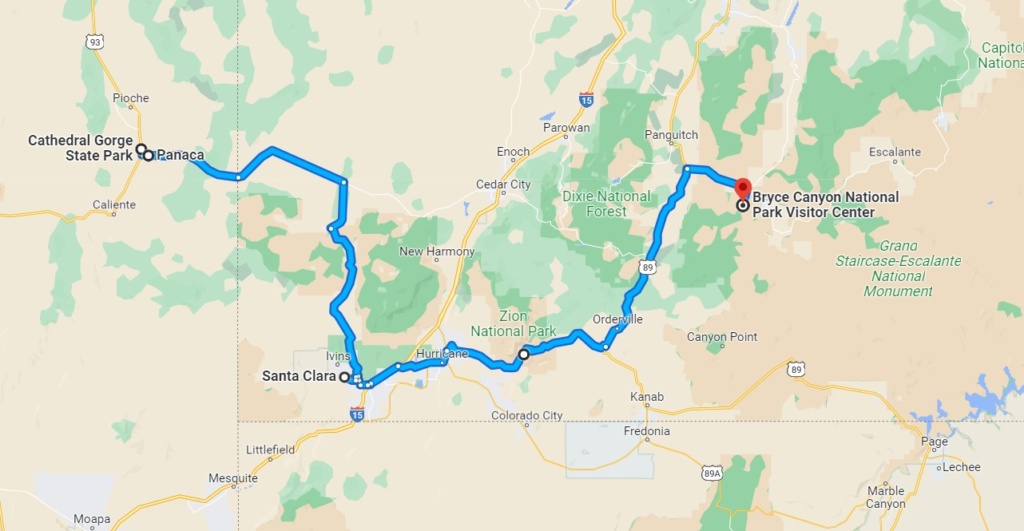
Arrived in Santa Clara yesterday afternoon, at last in southern Utah ! We were in the library car park when Teena approached us and asked questions about the roof tent as she was considering getting one. We got talking for a while and Teena ended up inviting us round to her house and allowing us to use her back yard to park for the night and we gratefully accepted. We had some nice discussions and enjoyed our time there. Thanks Teena for being trusting and so welcoming !
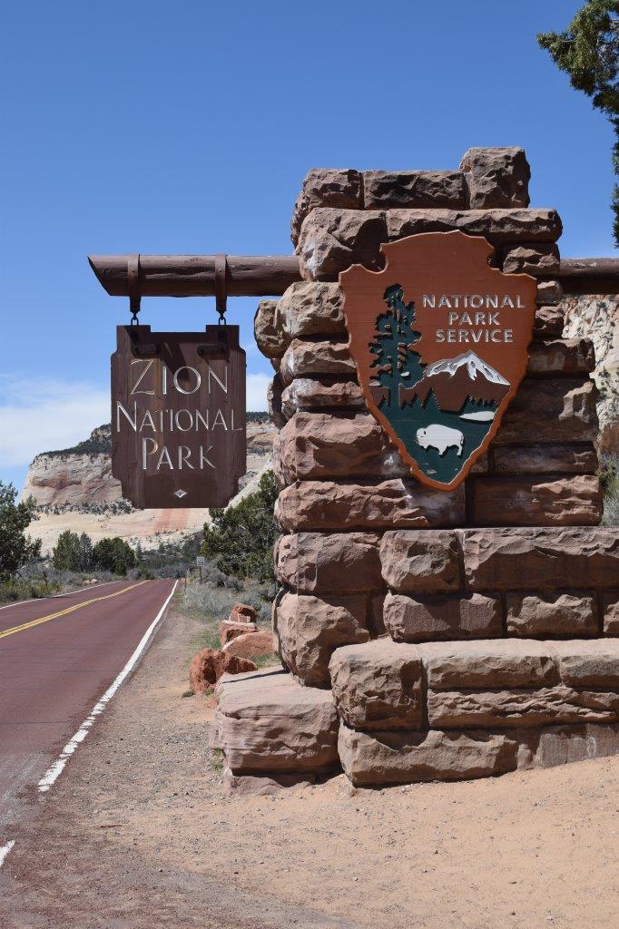
Zion Canyon
After getting information and maps at the Visitor Centre, we boarded the shuttle which runs through the Park and stops at the major points of interest/ trail heads. The shuttle is free and runs every ten minutes or so. This was introduced to avoid car congestion on the single road and damage to the fragile eco-systems due to car pollution.
Zion Canyon map
We only had a few hours the first day so we stopped at Court of the Patriarchs, so called because the 3 peaks were names by the Mormon pioneers after biblical Fathers: Abraham, Isaac and Jacob. A short trail leads to a view point.
We then carried on to the next stop and did the hike leading to a succession of waterfalls called the Emerald Pools. The temperature was in the mid twenties and it was great to be able to enjoy the scenery in the warm sunshine.
[Click on picture to open gallery]
The next day, we did another trail in a different part of the park called Kolob Terrace. The road there was not cleared of snow all the way so we turned back and did the Hop Valley Trail. Most of the trail was in a sandy semi desert valley following a river and quite muddy in places. It was ok but not that interesting scenery.
[Click on picture to open gallery]
Angels Landing Hike– 5 miles
Angels Landing is a 1,488-foot (450m) tall rock formation. A renowned trail cut into solid rock in 1926 leads to the top of Angels Landing and provides panoramic 360 degrees views of Zion Canyon. To complete the last portion of the hike you need to enter a lottery as the number of places is limited and each entry is timed to avoid overcrowding. The last 1/2 mile or so of the hike is definitely not for the faint of heart. This strenuous final section of the hike features steep drop-offs of 800 to 1,000 feet(250 to 300 m) on either side as you ascend 500 feet(150m) along a narrow mountain ridge. Chains and carved steps provide a little support and security. At the top, you stand at 5,790 feet (1,765m) elevation.
We were not successful in the lottery but decided to go on the hike up to Scout’s lookout which is as far as you can go without the required ticket! The first two miles of the Angels Landing hike follows the paved portion of the West Rim Trail, then you go through Refrigerator Canyon, the only part of the trail which is shaded, which even now in April is a welcome respite from the sun, by then you have ascended 1,000 feet( 300m) and you still have to tackle a series of 21 switchbacks known as ‘Walter’s Wiggles.” The wiggles are named for Zion National Park’s first superintendent, Walter Ruesch, who constructed the switchbacks in 1926. Walter’s Wiggles lead to Scout’s Lookout, where you get an impressive view of Zion Canyon below.
We paused and admired the view then decided to continue on the West Rim Trail for another couple of miles or so. we were rewarded with more fantastic views of Zion Canyon.
[Click on picture to open gallery]
We turned round and went back down to the shuttle stop to ride to the last stop: Temple of Sinawava. This is a natural amphitheater carved by the Virgin River. There are a couple of trails and the end of the paved Riverside Walk marks the beginning of The Narrows: Zion’s famous hike in the Virgin River.
The Narrows is the narrowest section of Zion Canyon. This gorge, with walls a thousand feet tall (300m) and the river sometimes just twenty to thirty feet (6 to 9m) wide, is one of the most popular areas of the park. This involves wading upstream, walking in the river and therefore is weather dependent. The hike is usually closed in spring as the flow of water is too high (due to snow-melt). Even in summer you have to check the weather forecast on the day as this narrow gorge can be deadly if you are caught out in flash floods during a storm!
It was closed when we visited but we walked along the river and saw a waterfall.
[Click on picture to open gallery]
From Zion Canyon, the quickest way to Bryce Canyon is to follow road 9 which goes through Zion- Mount-Carmel tunnel (see on map above ). This is a scenic road and just after the tunnel there is a trail leading to a look out with a beautiful view of Zion Canyon.
[Click on picture to open gallery]
Bryce Canyon
We had a storm last night and it is still very windy this morning. We drove to Bryce Canyon and had snow on the side of the road.Bryce Canyon elevation is averaging around 8,000 feet (2438 m) and reaching up to over 9,000 feet (2743 m) so it is not surprising that some areas of the park are still under heavy snow.
We drove as far as we could on the Scenic road then did the Queens Garden trail going down to the floor of the Amphitheater (a hoodoo-filled depression lying below the Rim Trail hiking path). The crimson-colored hoodoos, which are spire-shaped rock formations cover a vast area and the various look-outs on the scenic road give a good aerial view but it is also rewarding to go down and stand by the hoodoos and admire their twisted shape close-up. We were glad to have our woolly hats on, as the wind was really cold and so strong that it was pushing you around!
Nevada is mainly desert covered in sagebrush and the monotony of the road was only relieved by snowy peaks. We were mostly at an elevation (between 1,200 and 2,000 m) and even though it was sunny it was cold and the wind was relentless.
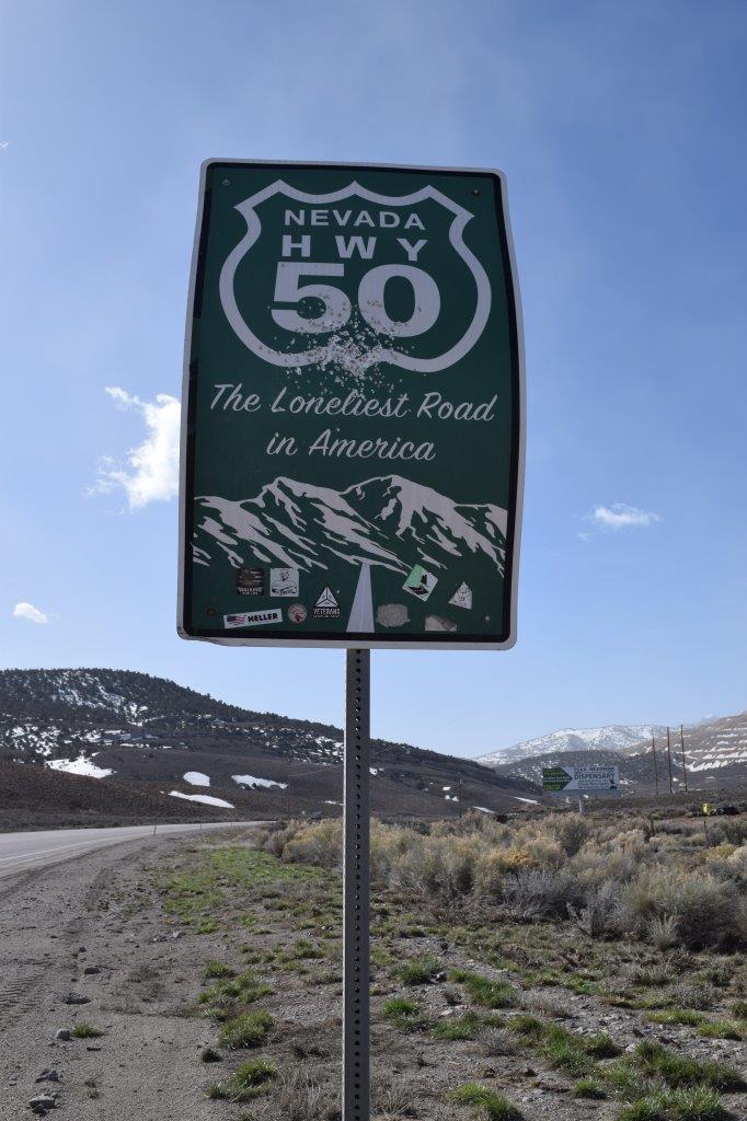
Near Eureka, we joined Highway 50, aptly named “the loneliest road in America”.
The only redeeming fact was that we stayed at a couple of nice BLM camps… in the middle of nowhere. One in particular had the added bonus of free showers, directly from a hot spring !
[Click on picture to open gallery]
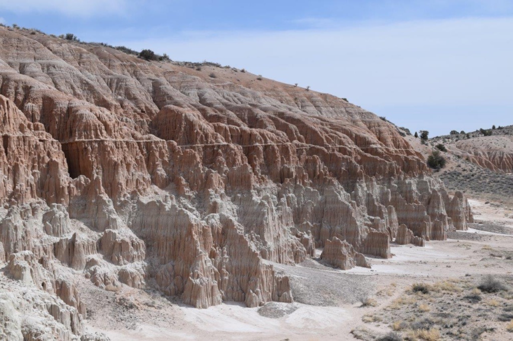
Cathedral Gorge State Park – Panaca
Cathedral Gorge SP is a geologic preserve featuring a dramatic landscape of eroded soft clay in different gradient of pink. Trails take you to spires, caves or slot canyon-like formations, many are narrow passages with fluted towers, hence the name of Cathedral Gorge.
The entrance fee is $10 and you can stay at the campground for another $10 per night so we decided to stay. We explored some of the caves and slot canyons. The wind was still very strong and the evening chilly. In the morning we got talking to our neighbours and Eric invited us for dinner that evening so we decided to stay for another night.
Both Eric and Sheree are involved in the music and AI (Artificial Intelligence) industries and they have a recording studio at the back of their trailer / motorhome. They spend half the year traveling and the summer back home in Idaho. We had a very pleasant evening, If you are reading this, thanks again Eric and Sheree !!
[Click on picture to open gallery]
A morning at the shooting range!
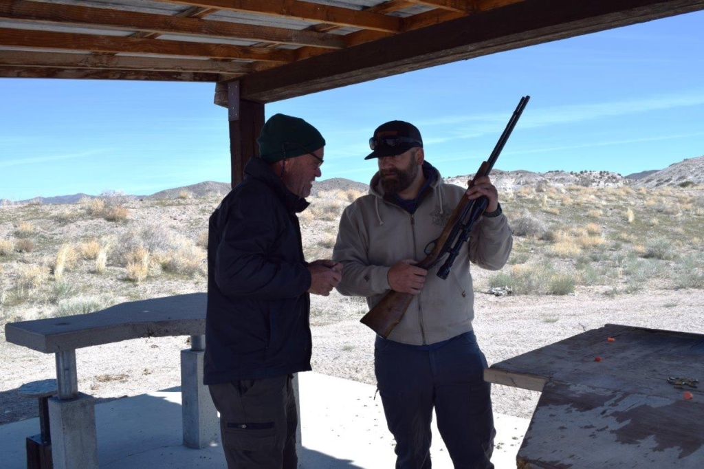
Yesterday, we were at the local petrol station/convenience shop and Paul got talking to the Sheriff who was parked next to us. The conversation turned to guns and when John, the Sheriff heard that Paul had never shot or held a gun before he invited us to come round to the local shooting range the following morning.
We met as planned and John took us to the Shooting range, just out of town. He brought a selection of 5 or 6 riffles and one handgun, casually resting on the front seat of his truck…
After giving Paul the necessary safety caution and explanations, he gave Paul a set of ear plugs and handed him a .22 long riffle. He set a target ( tin cans) at 100 yards or so and gave further instructions on how to line up your sight with the target, how to control your breathing and press the trigger etc… John also mentioned that this was the same gun his 5 year old learned to shoot with!
After a few rounds( and hits !), Paul was handed each of the other guns in turn and the target was moved further back. John had brought a scope allowing you to see the furthest target at 300 yards. Paul did manage to get a couple of hits !
A couple of these guns were for hunting and they were louds!
Learning the basics!
[Click on picture to open gallery
We spent one hour and a half at the range and after thanking John for the experience and giving us some of his free time, we were on our way. The next destination was Gt George, in Utah !
It was sunny but the road to Crater Lake was flanked by walls of snow and the side roads had not been cleared so impassable.
We got to Crater Lake NP late morning and it was quite busy already. Crater Lake was formed 7,700 years ago, when a violent eruption triggered the collapse of a tall peak (Mount Mazama, then 12,140 feet tall)). Scientists marvel at its purity—fed by rain and snow, it’s the deepest lake in the USA (1,943 feet) and one of the most pristine on Earth. Crater Lake is famous for its deep blue colour and we were not disappointed. The contrast with the surrounding snow was stunning.
At this time of year you can only access the south rim, but in summer you can follow the 33 miles ( 53 km) road that goes round the crater and offers fantastic lake views, panoramic vistas of forests and meadows.
Instead we did 1.2 mile hike in the snow to Discovery Point where you have a better view of the small island in the lake. It was hard work! This area receives some of the highest snowfalls in North America and we sometimes had snow up to our knees. This is usually a trail for snowshoeing or country skying…
[Click on picture to open gallery]
The plan was always to do the Oregon Pacific Coast so we headed west to Roseburg. We crossed a large area devastated by fire ( scenic road no longer !) with charred trunks for miles… then took small roads cutting through the coastal mountain range. There was snow on the ground and had to find an alternative route at one point as the road we were on had not been cleared of snow during the winter and was still closed. By then it was early evening and getting dark so we camped on a logging dirt road, in the middle of the forest, surrounded by snow. In the morning we found our way to the town of Remote, back on road 42 and drove to Coos Bay.
The weather was not with us, rain and low grey clouds meant that we could not even see the coast… The forecast was no better for the week. We stopped in town for breakfast at a local restaurant and after consideration, decided to head south to Utah!!!! It is no fun to be cold and not being able to cook outside, we wanted some warmer and drier weather! To confirm our decision we even had snow showers on the road on the way to La Pine….
It meant a long drive to reach the Nevada state line and then cross the state to reach southern Utah.
After leaving Woodlands, we drove through Berryessa Snow Mountain National Monument. The road took us through green hills, with flowers and trees in bloom. We saw plenty of Californian orange poppies and blue lupins. Sadly we also saw the ravages caused by the winter snow storms and earlier floodings which left lots of debris, branches and rocks all around.
We had some fog on the way to Mendocino and Russian Gulch State Park ( south of Fort Bragg). We are now in Redwood country and we did a hike to Fern Canyon. Nice walk ( 8km) going through a forest of Redwood and Ponderosa trees, ending at a waterfall.
[Click on the picture to open gallery]
We continued on to the scenic road called “Avenue of the Giants” , a 31 mile road running through Humboldt Redwoods State Park. It is named after the coastal redwoods that tower over the route. We stopped at the Visitor Centre and then headed for the Drury-Chaney Grove where we did a nature loop trail ( 2.4 miles), with tall redwoods towering over us. It was windy and we could see the tops swinging and sometimes crashing into each other with broken branches falling down!
[Click on the picture to open gallery]
We stopped for the night in Fort Jones, a nice little town, where we camped for the night in the local baseball team stadium car park. There was a toilet block with hot water and could get access to free local wifi !
The next morning we were on our way to Oregon and Crater Lake National Park.
We wanted to rejoin Highway 1 along the coast so took small roads cutting through the coastal mountain chain. Here again we had to backtrack a few times because of road closures but we had nice scenery and went through forest of the famous Coast Redwoods.( more on these in a later post!)
We rejoined Hwy 1 at Pescadero and headed north towards Half Moon Bay. This part of the coast is full of winding curves on the edge of the cliffs overlooking the shoreline . We stopped at Devil’s slide, once known for landslides and accidents, hence the name! This portion of Hwy 1 was first open in 1937 and was also the location of a military triangulation station and observation site used during World War II as part of the harbor and coastline defense of San Francisco. You can still see the building. In 2013 the coastal road around Devil’s slide was shut down and a tunnel for cars was built to replace this treacherous portion of the road instead. Now the almost 1 1/2 mile trail is the only spot along the Pacific Coast Highway where you can walk with no cars.
[Click on the picture to open gallery]
San Francisco
As we neared San Francisco, we stopped at a “Park and Ride” car park and took public transport to get into town. It was pretty straightforward, the train got us to Powell street, Downtown in just under 25mn.
We walked to China Town, passing the famous streetcars going up and down the hills.( SF is built over 7 different hills) then on to the Embarcadero and Fisherman’s Wharf and Pier 39 which has been transformed into a shopping area. From there you can board a ferry to go to Alcatraz, 1,5 mile away from the coast.
We continued on to Russian Hill from which you have a nice view of the City and the Coit Tower, a slender white concrete column rising from the top of Telegraph Hill, which has been an emblem of San Francisco’s skyline since its completion in 1933.
[Click on the picture to open gallery]
The next day we drove and crossed the Golden Gate Bridge and stopped on the north side at Vista Point. You have a view of the bridge and you can walk on the pedestrian lane on the bridge (watch out for the cyclists in the cycle lane who tend to go at speed!)
The Golden Gate Bridge, San Francisco’s most famous landmark, opened in 1937 after a four-year struggle against relentless winds, fog, rock and treacherous tides. It spans the Golden Gate, the one-mile-wide strait connecting San Francisco Bay and the Pacific Ocean.
After admiring the view we drove to another viewpoint on Hawk Hill, from which you get a better view as you are further away and at an elevation.
[Click on the picture to open gallery]
Car tires problem
As we left the view point Paul noticed that the rear left side tire was worn on side facing below the car and some of the carcass could be seen. This had to be looked at urgently so we drove to the nearest Tire shop at Mill Valley. They had to order it from San Francisco so we spent most of the afternoon in the Library. When we picked up the car they told us the problem was that the car was overloaded and the tire on the right side was showing similar damage. By then it was closing time on Friday and they were closed over the weekend.
We drove on to San Rafael where we found a spot for the night on a large car park near a lake called “The Lagoon”. The bonus was that the toilet block was open all night !!
The next day we drove straight to a big tire shop in town, very busy but they had the right tire in stock. We spend more time in the local library. Libraries are a godsend for us, as most town will have one, with free or cheap internet access, a warm place to catch up on paper work and are a pleasant environment.
We got the car back around 1 pm but were told that they could only do their best with the alignment because of the overloading. We will have to keep an eye on the tires and hope they last until the end of the trip!!
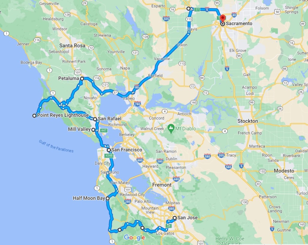
POINT REYESNational Seashore
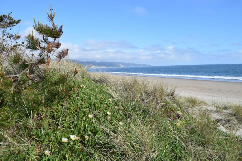
We rejoined the Hwy 1 by the coast and drove up to Bear Valley Visitor Centre. After a late lunch we drove to the Trail head for Limantour Spit. There, we had a walk on the beach. It was sunny but a cold and strong wind meant that the sea was really rough with big rolling surf waves.
The next day we drove to Point Reyes Lighthouse which stands on Point Reyes Headlands jutting 10 miles (16 km) out to sea and posing a threat to ships traveling between San Francisco Bay and locations to the north. Numerous shipwrecks occurred on these shores, battered by strong winds (forty-mph winds are common, and gusts have been reported as high as 133 mph) and treacherous rocks. The historic Point Reyes Lighthouse was built in 1870 to warn mariners of this navigational hazard and served for 105 years. It was retired from service in 1975 when the U.S. Coast Guard installed an automated light adjacent and below the historic tower.
To access the lighthouse, you have to take a short trail and then get down just over 300 steps! There are information panels along the way and a small museum.
The lens in the Point Reyes Lighthouse is the largest size of Fresnel lens. Augustin Jean Fresnel of France revolutionized optics theories with his new lens design in 1823. Before Fresnel developed this lens, lighthouses used mirrors to reflect light out to sea.
We then drove back to the Estero trail head and did the hike to Drake’s Head
[Click on the picture to open gallery]
The weather was still unsettled and a cold wind made cooking outside rather unpleasant so we booked an AirBnb in Woodlands, near Sacramento.
We stayed there for a week and enjoyed the luxuries of home living ! We spent a day in Sacramento, exploring the old “Historic Downtown” and visiting the Crocker Museum (partially housed in the Crocker family home, who donated their large collections of Roman and Greek antiquities, Asian and African masks, paintings and 18th century china tableware.
We left Death Valley, going west on Hwy 190 , going through the Panamint Mountain Range and getting a nice view of the Sierra Nevada and Mount Whitney, its highest peak at an elevation of 14,505 feet (4,421 m). At Olancha we joined the Hwy 395, the only way to get to Sequoia and Kings Canyon National Park, only to find out once we got access to wifi that the park is closed until mid April because of damage to access roads due to heavy snow and floodings. Same scenario with Yosemite NP!
Disappointed but we also wanted to follow Hwy 1 along the Pacific Coast so we carried on towards Bakersfield and Shandon where we spent the night at a Rest Area not far from the intersection where James Dean was killed in a car accident on September 30, 1955 . That historic site has a marker and has been named James Dean Memorial Junction.
The next day we drove to Cambria, a seaside hamlet hidden among Monterrey pines with plenty of charm, nice boutiques and art galleries and a vibrant culinary scene. it was overcast with showers and we took refuge in a French restaurant where we had a nice warm meal !
Hearst Castle
We drove on to San Simeon and Hearst Castle. This is the home that William Randolph Hearst started to build on his ranchland overlooking the village of San Simeon in 1919. He called the estate “La Cuesta Encantada” – Spanish for The Enchanted Hill. By 1947, the hilltop complex included a twin-towered main building, three sumptuous guesthouses, and 127 acres of terraced gardens, fountains, and pools.
The estate is the result of a long collaboration with Julia Morgan, an architect and engineer. She designed more than 700 buildings in California during a long and prolific career.
There is a selection of tours to visit the Castle . We selected the “Grand Rooms Tour” which gives you access to the Assembly Room, Refectory, Billiard Room, Theater, Gardens, Neptune Pool and Roman Pool; only a fraction of the 150+ rooms in the Castle!
Before boarding the bus for the 5-mile ascent to the top of the Enchanted Hill, you start the visit by viewing a 40mn film giving some insight in William R. Hearst, his origins, his early discovery of art while touring Europe when he was 10 years old, his financial success which allowed him to build his dream “La Cuesta Encantada” on top of a hill with superb views to the coast. He used the best materials and borrowed many features of classic roman and greek architecture to create his dream home and furnished it with his private collection of paintings, antiques and other objects of art.
In its heyday, San Simeon was the destination of choice for Hollywood’s elite. William Randolph Hearst and his companion, actress Marion Davies, extended coveted invitations to the time-honored greats of the movie industry: Charlie Chaplin, Cary Grant, Greta Garbo, Irving Thalberg, Bette Davis, Clark Gable, and many others.
[Click on picture to open gallery]
We wanted to continue on Highway 1 along the coast but had to turn back 10 miles or so after St Simeon as the road was closed for repairs due to damage caused by recent storms. There was no possible detour as there is a small chain of mountains running parrallel to the coast and no other road was available. We had no other choice but to retrace our steps back to Paso Robles and catch the Highway 101 to Salinas and then head for Monterrey on the coast.
By then, we did not want to go back south all the way to Big Sur so we stopped at Carmel-by the Sea. It was raining and very windy but the town is very pleasant , with beautiful cottages, gardens with flowers in bloom and an array of art galleries and boutiques. After walking for a while around town we took refuge in a small French restaurant! we had a nice hot meal and felt ready to forge ahead!
We drove up to Santa Cruz and then on to San Jose, where we met Daniel ( Cathy’s son) and had a nice evening in town. Daniel very kindly invited us to stay at his flat overnight and we readily agreed.
Thanks Daniel for your hospitality and pleasant evening !


")


")


")


 in middle")