May 30 – June 5, 2023
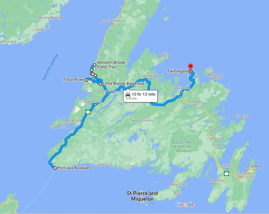
We crossed by the night ferry to Newfoundland and arrived at Port-aux-Basques just after 7:30am local time ( Newfoundland is 1/2 hour ahead of Nova Scotia time).
Gros Morne National Park
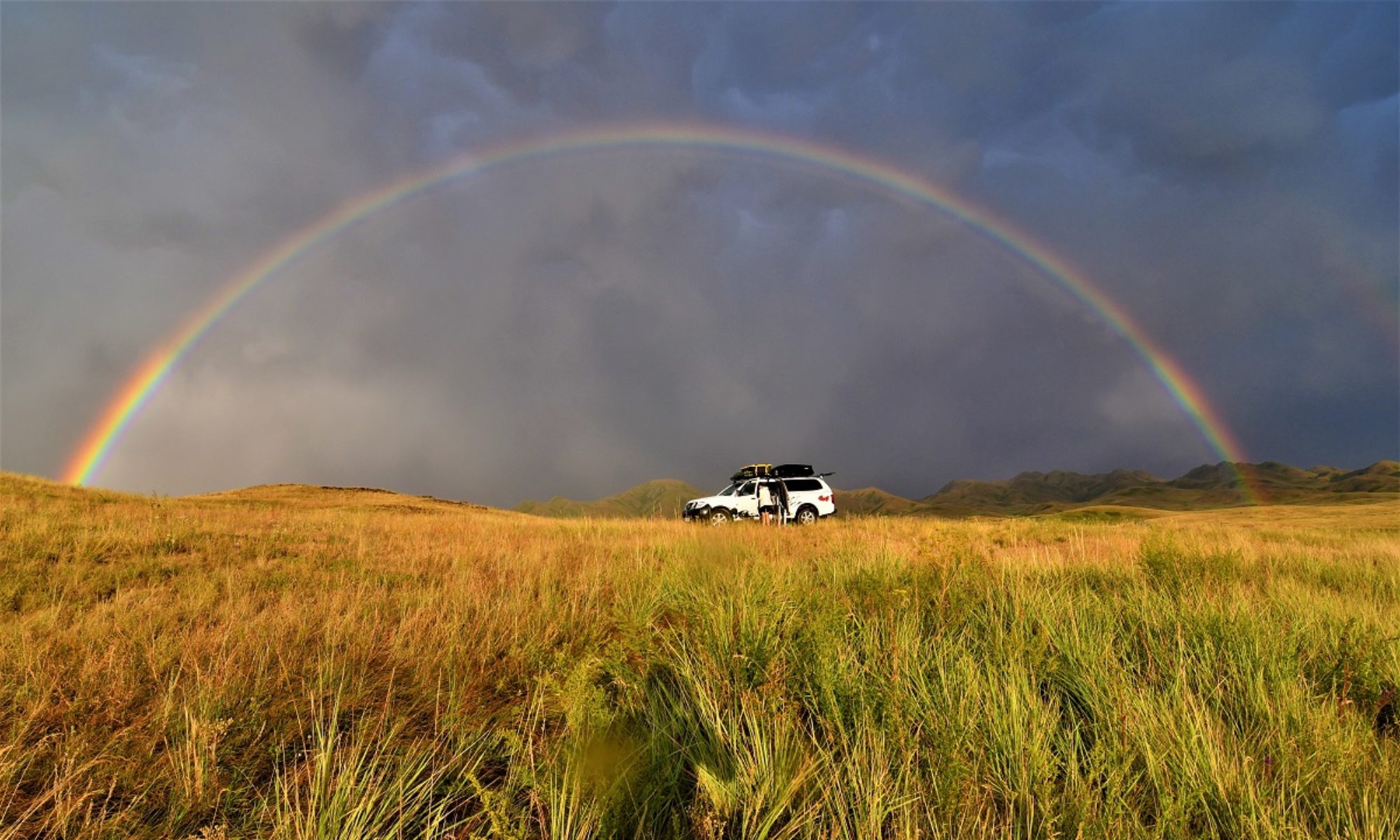
We knew there was a short window of good weather in the coming days so, straight away, we took the road to Gros Morne National Park, 4 hours away. It was sunny but not warm, with snow still on surrounding mountain tops. We stopped at the visitor Centre at Rocky Harbour and then drove on to Green Point campgrounds where we booked one night. We had a spot right on the coastline but it was very windy and started to rain late afternoon. We were glad there was a sheltered kitchen hut, with wood stove, sink and picnic tables inside where we could cook and spend some time away from the rain.. and not so warm weather!
One of the main attraction of Gros Morne NP is the Western Brook Pond, a fjord carved by glaciers with cliffs towering at 600m. The fjord is cut-off from the sea and is fed by rivers and snow melt. There is a 3km trail to get to the boat launch where you can go on a tour on the lake ( length 16 kilometers with a depth of 165 meters). We initially wanted to go on the tour but thought the $80+ per person was a bit too much so we just did the trail.


[Click on picture to open gallery]
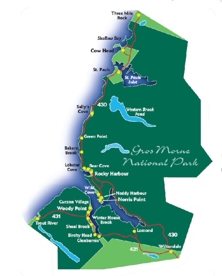
The next day we drove to Lobster Cove Head Lighthouse. The lighthouse was first erected in 1898. The round, iron tower was painted white and connected via a covered way to the keeper’s dwelling.
Robert Lewis was appointed the first keeper of Lobster Cove Head Lighthouse at an annual salary of CA$504. William Young succeeded Lewis in 1902 and kept the light until 1941, when his son, George Young, became the third and final keeper of the light. George was one of eight children raised by William and Esther Young at the lighthouse.
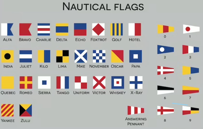
Lobster Cove Head became a signal station in 1898, when signal flags started to be used to send messages between ships and the shore. Each flag that was raised up the pole represented a single letter or a phrase, depending on the context. The W flag doubled as I require medical assistance, the U flag could mean You are running into danger, and the J flag carried the important message, I am on fire and carry dangerous cargo.
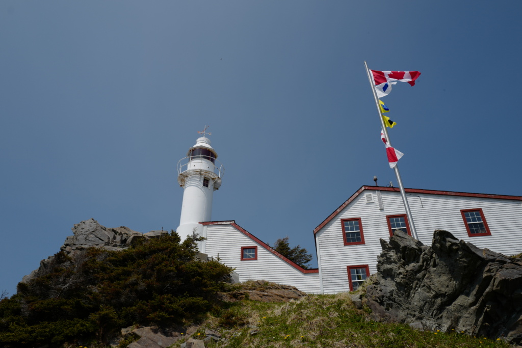
The lighthouse with the flag pole.
The Lighthouse was automated in 1969. The keeper’s dwelling was initially rented but transferred to Parks Canada and eventually opened to the public in 1990. Interpretive exhibits inside the dwelling describe the history of the inhabitants who lived along the nearby shore and their dependence on the sea. One wall of the exhibit is devoted to the keepers of Lobster Cove Head Lighthouse, and one room shows how the residence was furnished when occupied by the keepers.


[Click on picture to open gallery]
Gros Morne Mountain trail
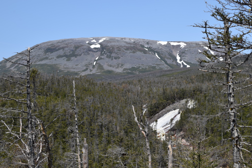
Gros Morne Mountain.
This is one of the most famous trail in the park. The weather was good so we decided to go for it.
This 806 m high flat-topped mountain is a slice of Arctic tundra far south of its usual range. The habitat here used to be the quiet domain of rock ptarmigan (related to the grouse), Arctic hare, and woodland caribou but now a trail leads to the top of this landmark. Around the summit there are views of a spectacular glacial-carved landscape: the deep fjord arms of Bonne Bay and the U-shaped trough of Ten Mile Pond.
To protect wildlife during critical weeks of growth and reproduction, the mountain portion, from the base platform, is closed to hikers beginning on May 1 and re-opens on the last Friday in June. The complete trail is 17 km long but we could only do the approach trail (9km) up to the point where the trail is closed temporarily. It is still a nice hike, passing waterfalls and offering splendid views.


[Click on picture to open gallery]
Tablelands
Gros Morne NP is divided into two very different sections. The otherworldly landscape of the Tablelands in the south, is completely different from the northern part of the Park.
The Tablelands are a geological marvel that helped scientists understand and prove the theory of plate tectonics. In this place, millions of years ago, two tectonic plates crashed together, forcing the Earth’s crust to buckle, and slide down deep upon itself, forcing part of the Earth’s mantle up over the crust. It creates an unexpected environment of unusual plants and striking vistas.
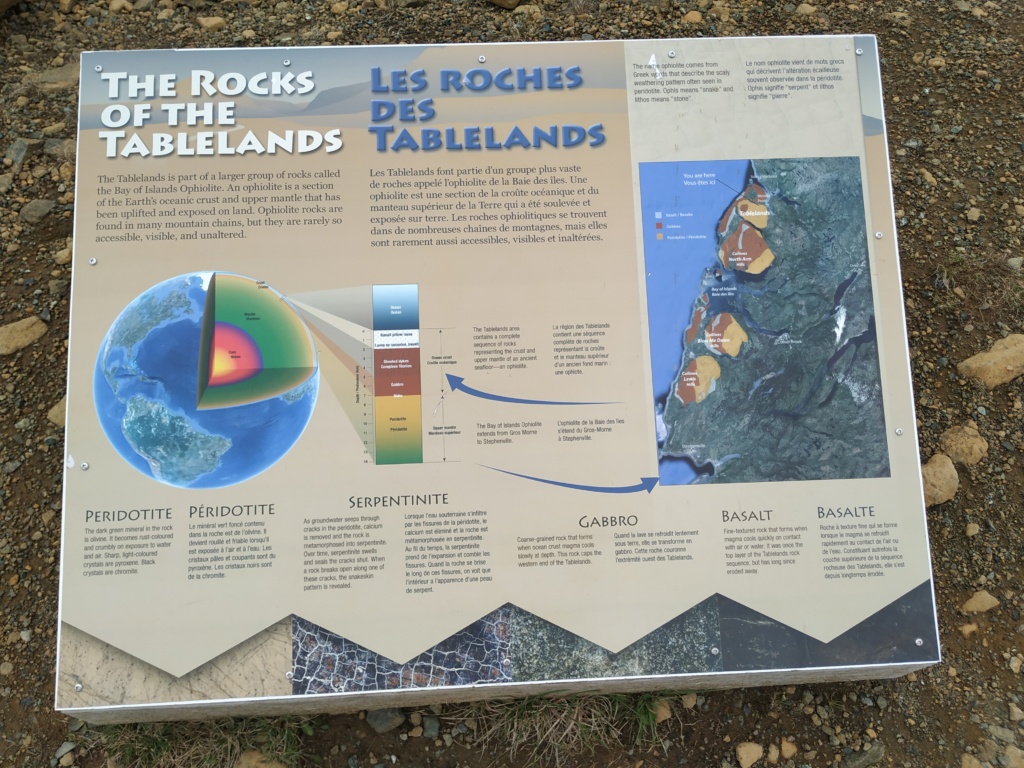
The peridotite rock is very dense and heavy and poisonous to many plants. Peridotite is dark green when freshly broken, but turns rusty brown and crumbles on exposure to air and water.


[Click on picture to open gallery]
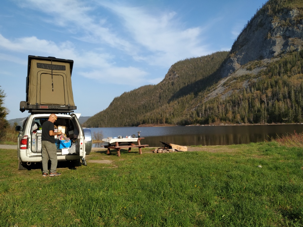
We camped overnight near a lake( Little Bonne Pond) and had very loud toads “singing” all night !
For our last day in Gros Morne NP, we continued on road 431 to Woody Point and stopped at the Discovery Centre. We spent some time there going through the exhibition and informative panels about the Mi’kmaq people, their way of life, how they made canoes from birch bark and used every part of animals they killed: not only meat but fur, hide, ligaments, intestine, bones and antlers…
Hummingbird carved in antler
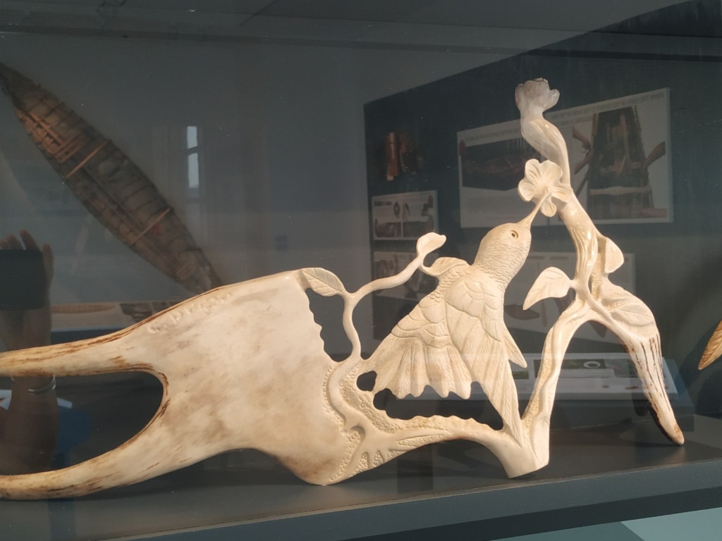
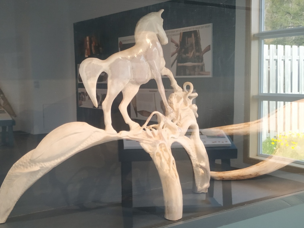
Farmer, a wild and angry horse, its muscular and aggressive stance contrast with the delicacy of the roots interlacing along the lower antler branches
We then did the Lookout Trail (5.5km), starting at the Discovery Centre. It offers one of the best panoramic vistas in the National Park. You climb steadily through forest and then emerge from the trees onto a highland plateau. From the platform atop Partridgeberry Hill you enjoy spectacular views of Bonne Bay, Gros Morne Mountain, the Tablelands and the Lookout Hills.


[Click on picture to open gallery]
We drove to Trout River, a small fishing village with typical small wooden huts called shanty near the harbour.


[Click on picture to open gallery]
Twillingate
We left Gros Morne NP and made our way to Twillingate, a small town on Twillingate Islands in Notre Dame Bay, off the north eastern shore of Newfoundland. The weather had turned to rain, even sleet and it was cold: 2 degrees celcius!!
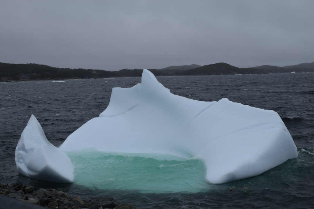
Known as the Iceberg Capital of the World, Twillingate is one of Newfoundland’s best locations for admiring these giants of nature that break off the ice cap in Baffin Island, Greenland. It can take icebergs up to three years to reach the coast of Newfoundland, by then they have already lost about 85% of their original size. The stretch of coastline that the icebergs hug during their travel south around Newfoundland is known as Iceberg Alley.
Iceberg season lasts from April to July usually but can be longer the further north you go towards Labrador.
Newfoundland’s icebergs were formed 10,000 years ago, during the last ice age. Despite their size, icebergs move an average of 17 kilometers (about 10 miles) a day. Some come close to the shore and you can see them without going on a boat tour.
Even though icebergs are floating in saltwater, the ice has no salt. It’s compressed snow. If you melted an iceberg you would get drinkable fresh water after you killed any germs.
There is an App where people can record sighting of icebergs( the bigger ones), giving the coordinates and possibly pictures: icebergfinder.com and we used it to get to two icebergs that were close to the coast.
The weather had not improved overnight and the morning we went to see the icebergs, visibility was poor, we had sleet and a strong wind from the sea. We had to walk along the coast, facing the wind and my face just about froze!


[Click on picture to open gallery]
After Twillingate, we decided to come back to Nova Scotia as the weather was really bad (it is not fun to cook outside in gusty wind, rain and freezing cold) and the forecast did not show any improvement for the following 10 days. We drove back to Port-aux-Basques and took the ferry to North Sydney !!